Zur deutschsprachigen Version dieses Artikels
Our current excursion tip is taking us to Hochneukirchen and Maltern. Lonely pathways, beautiful nature and legendary points ensure an eclectic hike on simple paths.
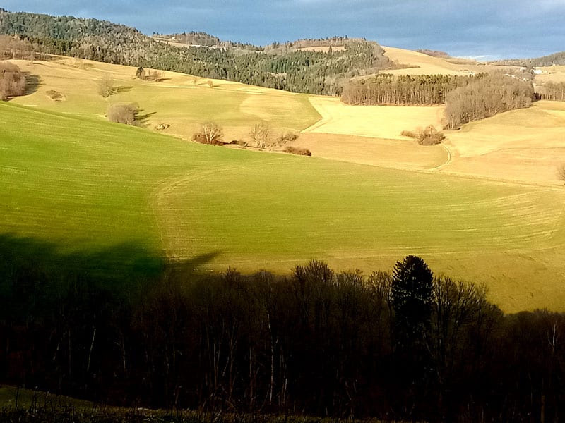
You can start this 11 km (370 m difference in altitude) hike either in Hochneukirchen or in Maltern. I personally prefer starting in Maltern; indeed, one has to cover the exhausting ascent first, yet, one is able to enjoy the comfortable way back. Besides, if you start in the morning, you will always find yourself on the sunny side.
We start in Maltern, at Kager inn, right on the street where you park. We follow the sidewalk along the road direction Hochneukirchen. Soon, we are spotting a church on a hill to the left, another five minutes later we pass a little chapel. When the sidewalk ends, you best switch to the edge of the field. Eventually, we arrive at a few houses. Here, an access road branches off to the left; on a roadsign you will spot the green marking. We follow it, pass a homestead at left hand side and reach a forest path that is leading us steeply uphill across a field. The path splits here. We chose the very right one and always follow the green marking. We enjoy a beautiful view of the valley here and almost feel reminded of Tuscany. The next section of the trail is relatively flat. The hiking route is leading us through between the residential house and the stable of a farm; it finally branches off to the left and leads up to the rarely used main road in serpentines; the main road takes us to Hochneukirchen via the cemetery.
Natural monument
You definitely should look at 650 years old linden tree here. Its trunk circumference is 5 m; its height is 20 m. In the town center, you can buy regional products at “Genusstankstelle”.
Eventually, we follow the signs on the mainroad direction Teufelsbründl. Attention: just before the end of town, a road branches off direction Maltern; we walk down this road for a few meters; then, we already see the next yellow indicator plate pointing to a country lane at the right. You have to be careful here and now follow the BLUE marking. The track now leads steeply downward along the edge of the forest to a small creek. According to the blue marking, we turn left here and traverse a field. Just before entering the forest, we turn right up over the brow and up there already spot rock formations and a sign telling us the legend of “Teufelsbründl” (devil’s well). There is also an impressive crevice here. Over a few rocks you get to the well that always contains water.
Afterwards, we follow the red marking downhill up to a derelict house; we turn left and steeply walk up to a farm. We continue walking on a paved neighboring street up to a fork; a sign indicates “Burgstall”. We turn right, pass two houses and discover a signpost directing towards Burgstall Ringgraben. At the first left turn, we take the country lane to the right. Looking up, we spot an old stonewall – probably deriving from the ring-ditch mentioned afore. Finally, we arrive at “Schwarzgraben”, pass a farmstead and leave the valley direction Maltern, always hiking along the forest road. Glorious silence and beautiful meadowland are our reward. At some point, we arrive at the mountain-bike trail, also following the country lane. At left hand side, a power place is awaiting the hikers. Established in 2015, around the “Industrieviertel” festival, there now is a small bench around a large chime. We have almost reached Maltern. At the village entrance, “Annaquelle” is located; for a small fee, one can take some healing water there: a sour water spring containing high amounts of magnesium and lithium. Soon afterwards, we reach Kager inn again, where one can stop for a bite to eat.
It is a great hike for all seasons. Nature lovers who enjoy exploring away from the big crowds of tourists will particularly like this hike. You should calculate 3 hours walking time.
Info
Dolores Marie Schärf unterrichtet Englisch, Französisch, Spanisch sowie Italienisch und ist als Dolmetscherin bzw. Übersetzerin tätig.

Tip from the Mountain Security Service
Dear leisure time sportsmen and sportswomen,
The mountain security service’s domain has changed a lot within the last 20 years. At the beginning of the millennium, we were still a pure rescue organization – today, however, we are also committed to environmental and nature protection as well as prevention – to avoid accidents in alpine terrain in advance and – if you will – with all the pleasant background effects that movement brings into our lives. The positive impact of exercise on our bodies is well known; now, the positive influence on our mind is increasingly coming to the fore. Until recently, our beautiful mountains and hills somehow served as sports “equipment” for training purposes – today, we realize a change. The beauty and uniqueness of the landscape are moving back into people’s focus. Especially in light of the climate crisis, a common and sustainable cooperation is becoming more and more important.
Erwin Jung
Photo: Bergrettung


Photos (8): Egerer, Graphic: Scherz-Kogelbauer GmbH